Featured post

Overland to London - Ephesus to Anzac Cove

  Celsus Library, Ephesus Day 87 (London Day 3)    Wed 20 August     EPHESUS – ANZAC COVE After a night-drive through from Pamukkale we a...

Friday, 19 May 2017

Islands in a Turquoise Sea

Islands in a Turquoise Sea Picture a great trireme, three banks of glistening oars slapping gently in an oily sea while a great square mainsail decorated with the stylised head of the supreme god Zeus or the sea-god Poseidon, flaps gently in the evening breeze. On the port-side lies a rocky island, perhaps it is Ogygia the home of fair Calypso, or Aeaea, island of the enchantress Circe, waiting to waylay, in a Cycladic paradise, the wily – and often gullible – Odysseus. Ever since I read Homer’s Odyssey many years ago, and listened to the lyrics of Tales of Brave Ulysses by the rock group Cream:
"And the colours of the sea blind your eyes with trembling mermaids And you touch the distant beaches with tales of brave Ulysses How his naked ears were tortured by the sirens sweetly singing For the sparkling waves are calling you to kiss their white laced lips"
my mind has tended to conjure up this image whenever I think of the Greek Islands. One can dream of splashing along a pristine foam-fringed beach where "… you see a girls brown body dancing through the turquoise" or to dive into the crystal-clear waters where "tiny purple fishes run laughing through your fingers". Of course today the reality is quite different with many of these fascinating islands now overflowing with tourists and the modern trappings that come with them, although traces of these islands’ classical heritage do, of course, still remain.
hat in ancient times invoked images of treacherous Scylla and Charybdis, or the ‘Clashing Rocks’ that so impeded both Odysseus and Aeneas, as well as Jason and his Argonauts during their quest for the Golden Fleece. There are about a 100 islands, excluding the large island of Crete, grouped geographically over 1000 kilometres into six archipelagos in the Aegean, Ionian and Myrtoan Seas. The easternmost island, Kastellorizo, lies just a couple of kilometres or so off the small Turkish Mediterranean port of Kaş with which there is little contact. The westernmost island is Corfu in the Ionian Sea off the Albanian coast and for 50 years in the 19th century was in the British Empire, even producing its own postage stamps with an image of Queen Victoria. For a student of classical mythology many of the islands feature prominently in the Greek myths. Delos was the birth place of Apollo; the inhabitants of Aegina were created from ants by Zeus at the request of King Aeacus who had seen his original people destroyed by Hera; Euboea was the island of Posiedon, God of the Sea and Ithaka was the home of Odysseus and his wife Penelope. For the student of classical poetry Lesbos was the island of the romantic poetess Sappho; "
Ah, what art thou but a fern-frond Wet with blown spray from the river                              Diffident, lovely, sequestered,                                                                                                Frail on the rock-ledge?                                                                                                   Yet, are we not for one brief day,                                                                                 While the sun sleeps on the mountain,                                                                           Wild-hearted lover and loved one,                                                                                   Safe in Pan’s keeping?
Hippocrates, the father of modern medicine, was born and practiced on Cos; Rhodes had its Colossus, one of the Seven Wonders of the Ancient World; Santorini was, perhaps, the site of Atlantis and Salamis saw the greatest sea battle of ancient times which guaranteed the Greeks freedom from Persian suzerainty. In recent times
Hydra was where the modern Greek navy had its beginnings during the Greek War of Independence in the 1820s; Corfu still has a cricket pitch, a relic of the 19th century British occupation and on Skyros the British poet Rupert Brooke was buried on the eve of the Gallipoli campaign in 1915 in:
"some corner of a foreign field That is forever England."
One of the most interesting islands is Santorini in the Cyclades. Sometime around 1500BC a massive volcanic eruption blew out the centre of what, until then, had been, more or less, a circular island. Today the result of that eruption has left a fascinating multi-coloured rim around a turquoise bay. Small, whitewashed villages cling precariously to the volcanic breccia overlooking Nea Kameni, a newly forming scoria cone in the centre of the bay, evidence that the fires of Hephaestus have not yet gone out. That Santorini was the site of ancient Atlantis is a theory first advanced by the Greek archaeologist Professor Spyridon Marinatos who excavated, and met his untimely end, at Akrotiri, a pre-eruption Minoan settlement on the island. Professor Marinatos suggested that the legend of Atlantis quite possibly stemmed from the eruption which, along with the succeeding tsunami, completely devastated not only Santorini, but the surrounding islands and parts of coastal Crete. The devastation of the eruption was such that the early Minoan civilisation on Crete suffered an irrecoverable decline and soon after was assimilated by the Mycenaeans from the Mainland. A apocryphal story relating to the founding of the ancient city of Troy could be related to this tsunami. It is said that a prince named Dardanus escaped from a great flood which swept over his home island of Samothrace by clinging to a raft of wood which carried him to the Kingdom of Teucer, Dardanus married Teucer’s daughter, founded a city on the slopes of Mount Ida which he named Dardania from which was derived the name Dardanelles, the strait of water separating Europe from Asia. Dardanos had a grandson named Tros from which the city of Troy took its name.
Santorini, with its two main villages of Thira and Ia is justmade for walking. Typical whitewashed Cycladic houses grace the narrow, steep lanes. At each corner something new springs into view. Ia, particularly, is most interesting and a photographers’ paradise. Part of the old village was destroyed in an earthquake early in the 20th century and the ruined buildings still remain, giving the village an air of mystery. Panoramas across the bay, particularly at sunset, are among the best in the Mediterranean and to sit in a tavern in the fading. rosy light of the setting sun with a plate of kalamari, a Greek salad and a glass of retsina, contemplating the words of Lord Byron, epitomises all that is appealing in these classical Mediterranean isles:
"Where burning Sappho loved and sung,                                                                               Where grew the arts of war and peace,                                                                       Where Delos rose, and Phoebus sprung!                                                                   Eternal summer gilds them yet,                                                                                       But all, except their sun, is set."


© Neil Rawlins  text & photography


Thursday, 15 December 2016

The 7.8 Earthquake in Kaikoura, New Zealand

It was raining when we left Picton and had been for most of the previous day when we had arrived on the Interislander ferry from Wellington. We were driving south and by the time we reached the small town of Seddon the rain had eased. We turned off Highway 1 onto Wakefield Street heading to Yealand Estate for an early Sunday morning vineyard tour and wine tasting. I was leading a group of 15 English tourists and today was the 12th day of a 25 day New Zealand tour. Over the previous days we had been to the Bay of Islands, as far north as Cape Reinga and driven down through Rotorua to Wellington before crossing Cook Strait. The weather had, in the main, been pretty good and everything had gone according to plan. At Yealand’s we were escorted around the vineyard by winery guide Nanette who talked to us about the diminutive babydoll sheep being bred to keep the grass down, had shown us the extensive expanse of neatly rowed vines, the solar-powered speakers that played classical music to the growing grapes and the chickens ‘employed’ to keep insects at bay. After tasting samples of Yealand’s excellent export-quality wine we were on our way to Kaikoura for lunch.
'Music in the Vines', sign on Yealand's Winery, Seddon

    After passing the salt pans of Lake Grassmere where most of New Zealand’s salt, both commercial and domestic, is produced we drove through the rolling grassy hills which lead to the spectacular coastal highway to Kaikoura. The South Pacific washes, at times violently, upon this rugged rocky shore and it is somewhat sobering to think that the next land out there is the coast of Chile, over 9000 kms away. Today the sea was relatively calm and the weather had improved considerably as we passed the interesting little stone church of St Oswald at Wharenui. As we drove towards the Kaikoura Mountains I gave my clients a basic insight into the tectonic forces of nature that are at work here – both on land and off-shore. The Kaikoura Mountains have been created by a series of active faults that join up with the rifts in the Awatere and the Wairau Valleys to form the Alpine fault that runs 600 kilometres down the western side of the Southern Alps. Not too far off-shore is the deep Kaikoura Marine Canyon where sperm whales hunt giant squid and seals and dolphins feed on other sea creatures that exist on the up-welling of nutrients from the cool waters of the canyon. I told them that these tectonic forces moved frequently on a geological time-frame, but only very slowly on a human scale – we would, of course, be safe but I could not guarantee it!
The rugged interior of the Seaward Kaikoura Mountains - pre-earthquake

    We crossed the Clarence River, which follows a fault between the two ranges of the Kaikoura mountains, then proceeded down the more rugged coast to Ohau Point, where there is a seal colony close to the road which was always a good place to introduce my groups to the kekeno, the NZ fur seal - Arctocephalus forsteri. Closer to Kaikoura we passed the famous Nin’s Bin which for about 40 years has been one of the cheapest places to purchase crayfish, the NZ rock lobster, which breed abundantly on this coast. It had been a couple of years since I had last visited Kaikoura but the town looked pretty much the same, although there was a new council building with a rather distinctive ‘craypot’ feature still under construction. The ‘Why Not’ café was as busy as ever as was the ‘Cray Pot’ next door.
The new local council offices & the Fish Tank Lodge, 10 hours before the Earthquake, Kaikoura

    We left Kaikoura around 2pm and drove out past the airfield. George, our driver, and I had decided to continue along the coast highway rather than take the Inland Kaikoura route and after a few kilometres drove through the first of the two road tunnels that can be tricky for a large vehicle to manoeuvre though. George muttered under his breath and made a comment that some fool in a car had made a partial attempt to overtake the coach as he was lining up the first tunnel. He said this was quite a common occurrence. There were plenty of seals on the beaches and rocks just off the road but no sign of the dusky dolphins which is one of the attractions of Kaikoura. In the distance I could see one of Denis Buurman’s Dolphin Encounter boats but we were too far away to make out any splashes caused by frisky antics of the duskies. In the past I had often seen them fairly close inshore. We drove along Goose Bay and through Oaro before climbing up into the Hundalees, a winding section of road that took us away from the coast. George and I both had memories of the old road the wound even more through these hills until re-alignment took place in the early 2000s. At Parnassus we turned onto the narrow Leader Road which follows the river of the same name through very attractive hill country and past the large hill station of Woodchester which even has its own small church. We stopped for a photo on Waiau Hill which overlooks the town and the braided river of the same name before making a stop at Brenda’s on Lyndon. All my group had large ice-creams, being amazed at just how much there was in a ‘single’ scoop for just $2.50. Next door is the Waiau Lodge Hotel where I had stopped for lunch on earlier tours. I had a quick look at the hotel while I was eating my ice-cream, it was pretty much as it had always been and I took a photo of the door to O’Malleys Garden (the hotel garden) where: ‘All ye who enter must wear a smile.’
Ice-creams at Brenda's on Lyndon, Waiau - 8 hours before the 7.8 Kaikoura Earthquake

        We crossed the long one-lane bridge over the Waiau River as we left town and after passing through Rotherham turned onto the road to Hanmer Springs. Hanmer Springs is just off the Lewis Pass Highway and the road crosses a narrow one-lane bridge high above the Waiau River Gorge. There is a sharp turn through a couple of cuttings in the crumbling schist rock before the road flattens out for the final few kilometres to the town. It was about 5.30pm when we pulled up at the Heritage Hotel in Hanmer Springs where we were staying for two nights. After an excellent dinner in the hotel we all settled in for the night. 
    I had probably been asleep about an hour when suddenly I was jolted awake. It was pitch dark and everything was shaking violently. I immediately knew it was an earthquake, and a very powerful one at that. The shaking and noise went on – and on! Lots of thoughts went through my mind – in an earthquake seek shelter – in doorways, there was just a bathroom which was not of a particularly strong wood, but then there was no way I would be able to stand up. Crawl under something – there was no table and the bed was only a couple of inches off the ground, so that was out. Well, I thought, as nothing was falling on me, it was best if I just stayed where I was in the bed. Eventually – it seemed like an eternity but it was in fact just two long minutes - the shaking finally ceased. I jumped up – there was no electricity but my cell-phone which was on charge provided sufficient light. The time, I noted was 00.04 on Monday 14 November. I pulled on some trousers, pulled on my jacket and raced down stairs. The hotel‘s emergency generator had kicked in pretty promptly and the stairs were well lit. I had no shoes on, but fortunately there was no glass. It suddenly crossed my mind that here was history repeating itself. In 1981 I had been involved in a coach accident in Poland when  a jerrycan of petrol in the boot of the vehicle we had collided with caught fire under our vehicle. We had had to evacuate quickly then, and again I had had no shoes on. My flip-flops were somewhere under the coach-seat. As I came out of the hotel I saw several of my passengers already outside. A hotel staff member saw me and suggested I race back and put on some shoes and something warmer. There was no evidence of structural damage to the hotel and there was nothing in imminent danger of collapse so I took his advice. Once back outside I rounded up my group. Half were already there and slowly one by one the rest appeared out of the darkness. Everyone was out of the hotel with no injuries and surprisingly in good humour – maybe it was the good old British stiff-upper-lip in the face of adversity! George went to the coach and brought it round to the front of the hotel, where, besides my group, other hotel guests climbed aboard and the running of the engine kept us all warm while the hotel staff, the local Civil Defence and the fire-service checked everything. It was then that we heard that initially it had been a magnitude 6.6 earthquake only some 15 kms from Hanmer Springs and at about the same depth. It was, of course, not then known how much damage had been caused or how widespread the quake had been, but everyone agreed that it had certainly gone on for a long time. The local fire chief appeared and told us that all seemed to be OK in the town but that we could not go back into the hotel until after daylight when any non-obvious structural damage would be seen. He also told us that the road out of town was blocked by slipping before the bridge, so everyone had no choice but to stay put – there is only one road into, and out of, Hanmer Springs. 
     After an hour or so, the hotel staff came up with keys for the hotel villas, privately owned but administered by the hotel. The long Canterbury Anniversary weekend – Friday, Saturday & Sunday – had just ended and many owners had gone back to Christchurch, so thankfully we were all able to move into these 3-bedroomed houses. We were told to try and get some sleep, which was easier said than done as aftershocks of varying intensity were occurring every few minutes. I managed to doze off for short periods, and I could hear George snoring in one of the other rooms. I got up at daybreak and walked through Hanmer Springs at just after 6. I was amazed that there was remarkably little damage – the quake had now been up-graded to magnitude 7.5 which meant it was even larger. The 4-Square supermarket had all goods shaken off shelves and I could see other businesses had items lying over floors but there was no apparent damage to structures, however the town was without power. The roads in town were all ok and as I walked back to the hotel I wondered if it had just been a dream. Just after 7am the hotel staff allowed us to collect our gear from our rooms and we were told we would be staying in the villas until our departure the next morning. At 8.30 the staff had cleared up the kitchen – there had been a lot of broken crockery – and provided a very good cooked breakfast.
The Heritage Hotel in Hanmer Springs, the day after the Earthquake - undamaged

    Power was restored to Hanmer by about 11am which was sooner than we had expected. Aftershocks were still continuing with the strongest, a magnitude 6.3, occurred as a few of my group were having a light snack on the deck of one of the villas. By now we were becoming a bit blasé about the aftershocks. We knew this was quite a big one but no one batted an eyelid. One of ladies was skyping from her ipad to a relation overseas when it struck. He asked what the noise was, to which he received the reply: “Oh, just another earthquake!” Late on the afternoon of the earthquake, the road and bridge out of town was re-opened for a couple of hours but was closed through the hours of darkness. By the time we left Hanmer Springs at 6.45 on the second morning the road was open and we were fortunately able to keep to our planned itinerary and catch the TranzAlpine train at Springfield for our journey into the Southern Alps to Arthur’s Pass. By this time we had heard just how widespread and devastating this earthquake – or earthquakes – had been. Kaikoura had been completely hammered. The spectacular coast road had been badly damaged with numerous massive slips, the tunnels were completely blocked and the seal colony at Ohau Point had been destroyed, although fortunately the New Zealand fur seals are night feeders and most would have been at sea and it was just before the calving season.  It has been estimated that the seabed had risen about a metre with paua (New Zealand abalone), crayfish and beds of kelp now exposed. Around 11,000 tourists were isolated in the town itself to which there was now no road access. The effects of the earthquake, up-graded first to 7.5 then to 7.8 was felt as far away as Picton and Wellington, both of which suffered considerable damage. The small town of Waiau, which was closest to the epicentre, suffered badly and the Waiau Lodge Hotel was all but destroyed. The approaches to the bridge had dropped around 40 centimetres, but the bridge structure survived intact. Geologists all agreed that this had been a major seismic event with at least seven active faults making their presence known. There were massive ruptures in the roading infrastructure and fissures of varying lengths and depths zigzagged across farmland. There had been over 80,000 rock falls, some huge. As the reports, along with pictures, came in, we realised just how lucky we were. Hanmer Springs was not much further from the epicentre than Waiau yet there was remarkably little damage. As I walked around town I noticed one section of carparking on the main street had been cordoned off with just three stones from a decorative building support lying within. Rather ironic I thought when compared to the damage in Kaikoura, Waiau, Seddon, Picton and Wellington but I was not complaining, Hanmer Springs had been on the right side of the fault lines, the force of which went in the opposite direction, away from the town.

© Neil Rawlins  text & photography

Books by Neil Rawlins available from Amazon


Sunday, 23 October 2016

Bikaner: a Desert City in Rajasthan

“Almost there!” “You said that half an hour ago.” “I mean it this time. Look, you can see the lights of Bikaner.” Sure enough, from the dusty gloom of the carriage the distant fairy-lights of Bikaner twinkle in the distance. It has been a long train journey from Delhi and we are glad to arrive. The railway station in Bikaner is reasonably new and nowhere near as chaotic as that of Old Delhi. Porters carry our luggage to the waiting taxis and soon we are installed in the relative comfort of the Dhola Maru Tourist Bungalow. Bikaner is very much a frontier town and, as the border with Pakistan is not so very far away, the town is the head-quarters of the Border Security Force, originally known as the Bikaner Camel Corps. The town, although modernised by the more recent Maharajahs – once among the wealthiest in India – still retains much of its unspoilt ethnic charm. The centre is dominated by the massive Junagadh Fort which dates from the latter part of the 16th century.
Junagadh Fort, the Royal complex of the Maharajah's of Bikaner, Rajasthan
The entrance to the Fort is through three heavy iron-lined wooden doors, adorned at elephant-forehead height with rows of vicious metal spikes, each about 15 centimetres in length; no doubt an effective deterrent against a pachyderm battering-ram. On the wall to the left of the second door is something far more sinister. These are the Sati handprints, now embossed in stone, left by the unfortunate royal widows of Bikaner whom, on the death of their royal husbands, have calmly elected to join the ranks of the divine and condemn themselves to self-immolation. Although this practice was outlawed in British India in 1829, sati persisted for much longer in the Indian princely states. I once met a Rajput, a member of the Royal Family of Jodhpur, who told me he had witnessed ‘Royal sati’ as late as the mid-1950s and incidences, particularly in rural India, still occasionally occur today. Once a woman has become sati she becomes a sati mata or sati mother, a fertility goddess. Every morning at the Bikaner Fort, a Hindu priest performs puja on these sacred handprints. Each is splashed with ghee, or clarified butter, a tikka blessing is daubed in red in the centre, and sticks of sweet-smelling incense are lit.
Embossed sati handprints at the entrance to Junagadh Fort, Bikaner
Junagadh Fort is a delightful example of the decadent splendour of the India native princes who once controlled large areas of India under the protection of the British. Now fast falling into decay and all but deserted by its former inhabitants, the fort has been preserved as a museum. Although many rooms have been stripped of their original fittings and adornments, one can invariably speculate on their former splendours. In some rooms portraits of former rulers glare sternly down upon the itinerant visitor, while in others the god Krishna and his milk-maids perform their eternal celestial dance of love across the walls and ceilings. Floral and gilt ceilings still impress and bejewelled thrones still await the returning Maharajah. One small balcony is completely decorated with what appear to be a mixture of Delft and Chinese willow-pattern porcelain tiles.
Painting of a Maharajah & the 'willow pattern' balcony, Junagadh Fort, Bikaner
In the gloomy Hall of Public Audience moth-eaten relics of the hunt gaze sullenly from between ceremonial and sporting elephant-howdahs and camel-saddles. At the far end of the Hall lie two tattered canvas-covered frames sporting R.A.F. roundels. A fading sign tells us that these are the only two Bristol Bulldog fighter aircraft left in the World, a gift from the grateful British to Maharajah Ganga Singh of Bikaner in recognition of his services as the Indian Commander-in-Chief during World War I. The aircrafts’ wings lie neglected in a nearby passageway. Another room is devoted to memorabilia of Ganga Singh; the ox-plough with which he inaugurated the construction of the Ganga Irrigation Canal, an ambitious project which had far-reaching economic benefits for Bikaner; an oil painting of Ganga Singh receiving a decoration from King George V at Buckingham Palace; a print of Ganga Singh at the Treaty of Versailles – he was India’s signatory; a caricature of delegates, of which he was one, at the 1930 Round Table Conference on the future of India held in London. Even outside the Fort the memory of Maharajah Ganga Singh lingers. There is a fine equestrian statue of him in a nearby park. In the afternoon we travel by taxi to the locally important shrine of Karani Mata in the small village of Deshnoke, some 35 kilometres from Bikaner. This temple is better known as the ‘rat temple’ and is said to be the only one of its kind in India. To the devotees the rather diminutive species of the genus rattus that exist here in their thousands are rather less important than the spirituality of the goddess, Karani Mata or, to use her full title, Bhagwati Shri Karniji Maharaj who is believed to be an incarnation of Durga, wife of Shiva and the Hindu goddess of anger and destruction. The temple, situated in the centre of Deshnoke, is built like a small fort. The entrance is of the most exquisitely sculpted white marble. The sculptor has intertwined vines, flowers and trees with peacocks, rats, gods and goddesses. To enter the temple visitors must remove their shoes. “You’re joking!” “No way, I’m staying in the bus”: “Are rats rabid?” “Can you get rabies from rat-droppings?” “No, at best, they just trim your toenails!” Somewhat warily most of the group enter. At the entrance to the inner courtyard, also a paragon of the marble-sculptors art, the first rats are encountered at close quarters. Inquisitive rodents investigate white toes, but one or two quiet screams and a quick shuffle or two keep them at bay. The entrance to this inner courtyard is flanked by two beautifully worked silver doors depicting Karani Mata in her earthly historical form. According to local tradition she lived in Rajasthan from the end of the 14th until the middle of the 16th century dying, or as she was a goddess incarnate, disappearing in a brilliant flash of light at the grand old age of 150. Karani Mata was renown throughout Rajasthan as a miracle-worker and was adopted as patron goddess by the Rathor Rajputs who ruled Bikaner and the neighbouring state of Jodhpur.
Guardian of the Hindu Temple of the Rats & a silver image of Karani Mata, Deshnoke, Rajasthan
Within the silver doors one crosses a small courtyard to reach the innermost sanctuary, the sanctum santorum. Here rests the sacred image of the goddess. Local legend states that this image was commissioned by Karani Mata herself from a blind carpenter. She revealed herself to the carpenter just long enough for him to form a perfect visual image which he then transformed into stone. The goddess had reasoned that as the carpenter had been born blind no other outside influences were likely to sully the work in hand. Once Karani Mata had accepted the blind man’s completed masterpiece she restored his sight permanently. In front of the image large platters of grain have been placed, food for the myriad rats, believed to be the souls of holymen, that squabble and scurry throughout the temple complex. The sighting of a rare albino rat is regarded as a good omen. By now nerves are beginning to crack and rather gingerly we retreat to where we had left our shoes. The sun was now lowering in the dusty desert skies as we arrive at the National Research Centre on Camel on the outskirts of Bikaner. Formerly the breeding centre for the Bikaner Camel Corps, the centre is a small Government run establishment dedicated to the improvement of local camel-stock and research into all other aspects of camel husbandry. Workers proudly show visitors around the breeding and feeding pens. In one row of pens a number of large males are tethered, awaiting expectantly their turn to service one of the many ovulating females, known as cows. The then director of the Centre, a Dr Chaudhuri, who had obtained his agricultural degree at Lincoln University in Christchurch, New Zealand, is an amazing wealth of facts and figures concerning ‘his’ camels, even down to the number of spermatozoa per millilitre of seminal fluid of which, incidentally, the camel has less than most other mammals.
'You want see camel make love?' National Camel Research Centre, Bikaner
We are just about to leave when a staff member excitedly asks us if we want “to see camel make love”. Who could refuse such an offer? This was a bizarre and somewhat frightening ritual in which it is surprising to learn that modern domesticated camels require human assistance to mate successfully. With the male frothing at the mouth and hideously inflating his soft palate and the kneeling female roaring loudly and attempting to bite the neck of her paramour, we are amazed that baby camels are ever conceived at all. The rays of the setting sun are now mingling with the desert dust and the smoke from a thousand cooking fires. A lone vulture, perching in a thorn tree, is silhouetted against a reddening sky as we leave the Research Centre to return to Bikaner.

Travel books by Neil Rawlins available on Amazon.


Friday, 2 September 2016

By Camel to Jaisalmer, Rajasthan

Off into the Thar Desert, Rajasthan
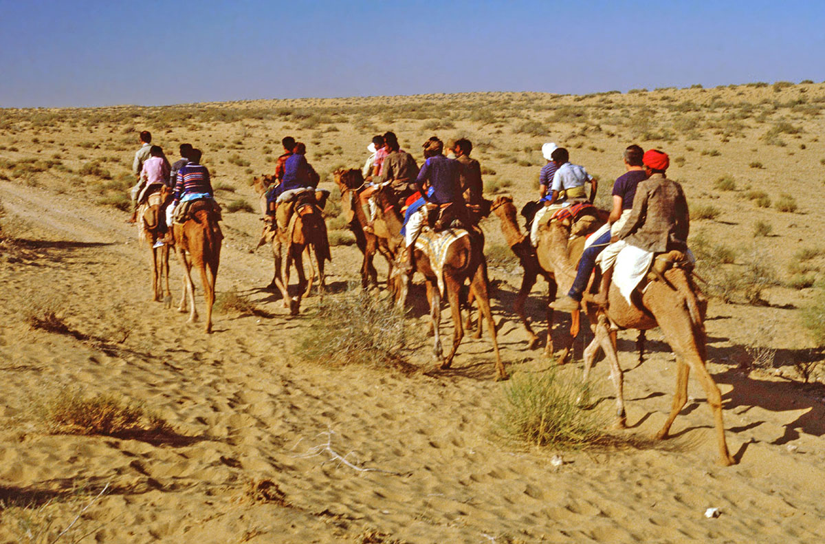
The shadows were lengthening when we reached the small desert village of Nachana. Here we were introduced to our allocated camel, along with the ‘driver’, a local Rajasthani who would ride behind each of us. This would be our only means of transport for the next five days. To the accompaniment of much bellowing and groaning from these cantankerous beasts, we each clambered onto our camel saddles. This was always an interesting excercise. First, scrambling onto what, by our standards, is an uncomfortable saddle, Then there is a three-way motion as the animal stands up and we had to be prepared for this. Fred Burnaby aptly describes this motion in A Ride to Khiva: ‘they go something like a pig with the fore, and like a cow with the hind legs. The motion is decidedly rough.’ With much roaring and protesting the camels finally stand up.But to top in all off, camels smell at both ends – halitosis at one and flatulence at the other!

The gait of each camel can be different. Some were bearable when one got used to their walking gait, but were unbearably uncomfortable at a trot, others were the complete opposite – and with all camels, when they had been coaxed to a gallop, the rider had to hang on grimly to the saddle to stay in place. After dismounting you then walked funny, and painfully, for a couple of hours afterwards. As St. John Philby in his book The Empty Quarter, describes it: ‘It is quite extraordinary how camel-riding calls into play nerves and sinews which seem to lie idle in all other occupations.’

A couple of camel-carts, carried our luggage, tents, food supplies and a tank of fresh water. Our cooks, Sherpas from Nepal, in their happy-go-lucky way were quite happy riding on these service carts. If we were able to entice them onto a camel it would, after much laughter, only be for a short time! They weren’t stupid!.
The shadows of our camels as we make our way into the Thar Desert
Once everything was loaded, we set off to ride to our first overnight camp near the small village of Satya, between one and two hours away. This first stint was really just an exercise to get everyone used to their camels and to let them know what they were in for over the following four days. We reached Satya just on dusk. The Sherpas had gone on ahead with the luggage and had set up the camp just outside the village. They were now preparing the evening meal.

It had also been time for us to get to know our camel ‘drivers’, usually the owners of the individual camels. They were an interesting bunch. Most of them did not speak any English, but were always friendly and certainly tolerant. There were some interesting weather-worn faces – typical of the Thar Desert. One of the older ‘drivers’, I was told, had served with the Jodhpur Lancers in the days of the British Raj, but as the Lancers had been disbanded a couple of years after the end of World War One it was far more likely that it had been his father who had been in the regiment.
The interesting faces of our camelmen - the supposedly former Jodhpur Lancer is on the left. 
The Sherpas were likeable young men who turned out amazing food, usually cooked over the coals of an open wood or camel-dung fire. My first Camel Safari was over Christmas 1982 and on Christmas day the Sherpas presented us with a traditional Christmas fruit cake, baked in the embers of the campfire. They had insisted on getting to camp a little earlier on Christmas afternoon and had been very secretive with their cooking and after the main course, proudly presented us with the finished product, much to the surprise and delight of everyone. A couple of local Rajasthani musicians also accompanied us; they rode on the camel carts with the Sherpas. In the evenings their music would attract the male villagers over to our camp. The villagers, their faces lit by the glow from the campfire, listened entranced to the music. This was one of the unforgettable memories of the Thar Desert. Occasionally, just at the peripheral edge of the fire-light, we would catch a glimpse of colourful sari-clad village women.
Villagers sit around the campfire, entranced by the music of our accompanying Rajasthani musicians
On our first morning in the desert I tried, not too successfully, to encourage the group to get up early to see the sunrise over the Thar Desert sand dunes near the village of Satya. It was quite cold just before the sun rose, but would quickly warm up. To me a sunrise in the desert was always a special time of the day when everything was quiet and still. The sun’s radiant disc would appear on the horizon, rising slowly into the hazy atmosphere, illuminating scrubby bush, sand dunes, then our tents and the mud houses of the village in an ever-warming glow.
The rising of the sun across the Thar Desert from the village of Satya
After breakfast we packed up and led our camels into the village of Satya for a look around. Satya is just a small cluster of mud-brick huts, immaculately kept by the village women, and a rather large complex for the village headman.
The headman's complex, Staya Village, Thar Desert
The men and children were watering the flocks of scraggly black-faced sheep, white Brahma cows, camels and donkeys, before taking them into the sparse desert scrub where somehow they found enough to eat. This was an age-old scene and having been used to the rich green pastures of New Zealand and England it never ceased to amaze me how these animals found enough to just survive, let only thrive in such an environment. Although Satya was accessible by a rough vehicle track there were no motor vehicles in the village.

Village girls chatting in the sun, Satya village, Thar Desert
In a sandy clearing near the centre of the village were a number of small sandstone cenotaphs, or chhatri. These are built on the cremation sites of the village headmen who have long-since passed on. Sati, or widow-burning, was not unknown in Rajasthan in the past and some of these chhatri had images of women carved into the soft sandstone next to the image of their husband. These represented the wives who had immolated themselves on their husband’s funeral pyre, thus joining the ranks of the divine and becoming sati mata or sati mothers, fertility goddesses.

Chhatri, or sati stones, in the cenotaphs of former headmen, Staya village
Once away from Satya, we were into the desert proper following an indistinct track through a sandy waste of stunted acacia scrub and other hardy desert plants interspersed with the occasional rocky outcrop. After an hour or so, one became used to the ship-like motion of the camel and as confidence grew, there were races where we coaxed the camels into an uncomfortable gallop. When we came upon a desert watering hole, we would take a welcome break while our camels 'refueled'.
'Refueling' at a desert watering hole.
Late afternoon on the second day we reached the village of Tadna. This small village was one of very few in India in the 1980s that had no vehicle access at all. Tadna was a cluster of mud huts surrounded by thorn-bush enclosures within which the villagers’ livestock would be kept overnight. It was an age-old scene; men and camels hauling water up out of the village well, pouring it into troughs for their animals to drink and women with clay pots balanced precariously on their heads fetching water for the days’ chores. As I wandered around the village I came across a coy young lady leading a small donkey, laden with decorated clay pots, heading towards the well. As I looked at her, the modern world felt so very far away which, in reality, it was. I could hear the soft hum of voices in idle chatter along with the bleating of sheep and the soft lowing of cattle, interrupted with the bad-tempered roar of a camel or the loud braying of a donkey.
The coy little village water-carrier, Tadna village
Tadna did have a small school-house and the next morning a class of enthusiastic children, each with a writing-slate, were sitting outside in the early morning sun, watched over by a flock of lethargic black-faced sheep.
Tadna village school, watched over by black-faced sheep.
The third day of the camel safari was the longest and the most monotonous. The barren desert scenery was, by now, beginning to wear thin and although we saw the odd herdsman with his livestock, there were not any villages on this section of our route. In the late afternoon we arrived in Sri Mohangarh, a small town dominated by a fort, said to be the last built in India. The battlements gave good views over this dusty desert town and there were two rather imposing white marble elephants above the entrance. Houses in Sri Mohangarh were larger, built of bricks and of less traditional design than those we had seen in the villages, and motor vehicles were not uncommon. We camped in an open area not far from the fort.
White marble elephant looks down from the fort in the desert town of Sri Mohangarh
Shortly after leaving Sri Mohangarh we passed a couple of more traditional mud brick villages before coming to a salt lake in the middle of the desert. Here nearby villagers collected supplies of natural white salt from this large evaporation pond, and most was sent to Jaisalmer which was now only about 40 kilometres away.
The small salt lake in the Thar Desert near Sri Mohangarh
The last night of the safari was spent near Hada, a small village of basic mud huts, several with elaborately painted entrances, and a small but impressive mud fort which was unfortunately, locked.
The small fort at Hada in the Thar Desert
The little houses in this village were interesting. One was occupied by a shoe-maker. He was, I was told, a Moslem and so was able to work with leather as the cow is sacred to the mainly Hindu Rajasthanis. Through another doorway I could see two children using a traditional spinning wheel for spindling wool. Against another hut was a stack of decorated large wide-mouthed pots for fetching water. This small village, with its fort and artisans premises, was indicative of the traditional Indian way of life, unchanged for centuries, which was now fast disappearing.
A painted mud-brick dwelling in the Thar Desert village of Hada
On the afternoon of the last day the ‘fabled’ city of Jaisalmer appeared on the desert horizon. There was always something romantic about the first sight of the yellow, crenelated towers of Jaisalmer when first seen from the desert vastness. This view reminded me of H.P. Lovecraft’s description of Kadath in his short story, The Dream Quest of Unknown Kadath: ‘All golden and lovely it blazed in the sunset, with walls, temples, colonnades and arched bridges of veined marble, silver-basined fountains of prismatic spray in broad squares and perfumed gardens…’

Approaching Malka Pol, the northern gate of the 12th century fortified city of Jaisalmer
Still riding our camels, we entered Malka Pol, one of the ancient gates in the outer wall of the old town. This outer wall denoted the extent of Jaisalmer to the north. In the 1980s there was very little motor traffic in the narrow streets of the city and we were able to ride our camels to the hotel which was quite an experience. We felt like real travellers of old coming in off this extension of the old Silk Road. Our hotel was the Jaisal Castle Hotel which was in the old fort, within the walled city. It was an overwhelming experience to ride our camels through the town, up cobbled streets and through the massive reinforced gates of the old fort into the courtyard by the hotel.

There was certainly something magical to be able to walk through the narrow cobbled streets within the fort, to stand on the battlements and look out across the newer city to the outer walls and beyond to the cenotaphs of Badabag and the stark Thar Desert which we had got to know intimately over the last four days. The Thar Desert camel safari was an unforgettable experience.

Travel books by Neil Rawlins available on Amazon.


Sunday, 28 August 2016

The Hole in the Fence - a Note from Mirjaveh, Iran 1979

I was recently sorting through some old papers when I came across a Christmas card I had sent to my parents in New Zealand. It was dated 26 November 1979 and written in Mirjaveh, Iran. I had added a short note saying that: “I’m writing this at a desert border post between Iran and Pakistan. It’s 7.45pm here but 200 yards down the road, when we cross the railway line and go through the hole in the fence it’s 9.15pm in Pakistan. The Iranians won’t let us out until tomorrow morning!” I also went on to mention that: “I’ll be well away from here when I post this, probably in Delhi.” The envelope hasn’t survived, but as I had to visit the GPO in Quetta a couple of days later to send telegrams to book the group’s onward accommodation in India, I would have posted the card there. We had left the city of Kerman early the previous day, driving into the Dasht-e Lut Desert towards Zahedan. About 90 minutes later the silhouette of the Arg-e Bam appeared out of the desert. This was the ancient citadel of the interesting desert city of Bam, described in Fodor’s Guide to Iran as the ‘loveliest oasis in Iran.’ The modern town was dominated by the mud-brick ‘Arg-e Bam’, a massive citadel which Fodors described as the largest adobe structure in the world, with sections dating back to around 500BC. The entire old city, mainly in ruins, was completely surrounded by massive mud walls which were then still largely intact. We paid the entry fee and spent an hour scrambling through the deserted ruins and up to the highest point of the citadel with sweeping views over the crenelated ramparts and the abandoned crumbling mudbrick dwellings. Bam, once famous for its textiles and clothes, had also been an important stop on one of the Silk Roads linking China and Central Asia to the Iranian cities of Isfahan and Shiraz and, ultimately, the ports of the Persian Gulf. The city and its caravanserai would be a welcome break on the journey towards the coast.

The mudbrick wall of the great fortress at Bam
I have used the past tense in my description of Bam as at 5.26am on the 26 December 2003 a massive earthquake of a magnitude of 6.6 on the Richter scale reduced this amazing centuries-old city to rubble. Over 26,000 people perished and more than 30,000 were injured. With assistance from UNESCO, Bam was on the World Heritage List, and the World Bank, certain features of the Arg-e Bam are to be restored. From Bam we continued across the Dasht-e Lut Desert towards Zahedan, stopping at about the halfway mark at what was known as the Mil-e Naderi. This mud-brick tower was a desert marker dating from the 12th century and was an effective guide to the caravans that made their way across these featureless wastes. At night a beacon was lit at the top turning the tower into a sort of land lighthouse. The condition of the road to Bam had been reasonably good but as we approached the desert marker it began to deteriorate badly. A British firm, Marples-Ridgway, was reconstructing the road and our coach was intercepted by one of the Company’s Landrovers. The English driver insisted we follow him back to their rather lonely road camp as he had noted we had a number of young English and Australian ladies on the coach. These isolated English roadworkers felt the need for a party, so they offered to put us up for the night, an offer we readily accepted. A good English feed was followed by a riotous session on their homebrew, an illicit enhancement of the local malt beverage. Since Iran was now an Islamic State under the tutelage of the Ayatollah Ruhollah Khomeini, alcohol was forbidden, but Camp C, as this isolated ex-pat camp was known, was far enough away from civilisation to be able to flout these laws. Three weeks before, just a few days before we left London, Iranian students and Revolutionary Guards had stormed the US Embassy in Tehran and taken 52 diplomats and other US citizens hostage. The hostage crisis was ongoing, in fact it lasted for 444 days, and the future of the Marples-Ridgway contract was up in the air. As it turned out, on my return journey a few months later I heard that the camp had closed and the British workers had returned home.
The Mil-e Naderi, the 11th century marker in the Dasht-e Lut Desert
Next morning, still feeling the effects of the ‘home brew’, we set off for Zahedan, a largely Baluchi town and I noted in my diary that the people did seem to be different from the other cities we had visited in Iran. We had been advised to stock up with food in Zahedan for a few days as the roads to the border and onwards into Pakistan were bad and the next large town was Quetta, some distance away. It was slow going to the border post of Mirjaveh which we reached around 2pm. In 1979 Mirjaveh was still a secondary border town. We had hoped to complete formalities and enter Pakistan that evening, but we found than the Iranians had closed their side of the border; it would open at 4pm we were initially told. There was no one else waiting at the border post and as 4pm approached we were told that the border would not now open until the next morning. A lone customs official was on site and after Colin, our driver, and I had tea with him he said they would put us through first thing in the morning. As there were no eating establishments in Mirjaveh, our Customs friend told us that if we followed the railway line there was a fence-gate on the border with a hole in it and a hundred yards or so further on was the small Pakistani village of Taftan where there was a basic restaurant, but we should keep in mind that the time in Pakistan was one and half hours ahead of Iran. The restaurant would also accept Iranian currency. As dusk fell we made our way along the railway line and through the hole in the fence. In the distance we could see the snows of the 4000 metre high volcano Kuh-i Taftan reddening in the setting sun.
The 4000 metre high Kuh-i Taftan volcano at sunset
The little restaurant had goats running around the tables and the food was Baluchi cuisine, more akin to spicier Indian and Pakistani foods than the blander chelo kebab we had been eating since we had been in Iran. After a satisfying meal we crept back along the railway, losing the hour and a half we had gained, to sleep on our air-mattresses in the Iranian Quarantine Centre. Next morning, true to his word, our Iranian customs friend made sure our group was first through the border and after clearing Pakistani formalities and changing money in Taftan we were on our way over equally atrocious roads towards Quetta, still another 20 hours away. We bumped and lurched through potholes and over deep corrugations until just after dark we stopped for a meal in the small town of Nokkundi, a ‘grubby little town’, as I noted in my diary. On entering a restaurant we were greeted in a loud voice, much to our amusement, by the maître d’ with a “No gentlemen here – only Baluchi”. I noted that the meal of vegetables, rice and naan bread was ‘quite good’. We then we set off to drive through the night to reach Quetta, largest city in the Pakistan state of Baluchistan, just after daybreak.
A street in the Pakistani town of Quetta

© Neil Rawlins  text & photography
For the full Overland story see my book: One Foot in Front of the Other - Full Stride


Wednesday, 24 August 2016

A Panegyric to an Overland Journey from KATHMANDU to LONDON 1979

On my first assignment as an Overland tour leader for Sundowners in July 1979, I was literally thrown in at the deep end. I was sent, along with a Kiwi driver, Merv, in a Capricorn Overland Seddon coach, to Istanbul to meet a group of mainly New Zealanders and Australians who were flying in from Kabul. The group had left Kathmandu several weeks earlier in a Sundowner's coach with another driver and courier, as tour leaders then tended to be called, and after travelling across India and Pakistan had driven up the Khyber Pass to Kabul in Afghanistan. Politically there was much unrest in Afghanistan with Soviet Russia asserting its influence, positioning itself for the invasion of Christmas Eve the same year. Iran was also in turmoil, the Shah had fled in February, anti-American political rhetoric was at its height and it was unknown how the ‘Revolutionary Guard’ would react to Western tourists. Sundowners felt it would be far safer to fly the group to Istanbul where they would be met by Merv and myself. I had been in Istanbul twice before, the first being in 1970 on my first Overland as a passenger, the second just a couple of months earlier on the Sundowners training trip. I had also been to Ankara and Cappadocia in central Turkey in 1970, but that was it, the rest of the journey through Syria, Jordan, Jerusalem, Iraq and back around coastal Turkey to Greece was new territory, as was the side trip to Egypt. The trip was successful and memorable and at the end of the tour I wrote a somewhat verbose panegyric of the Overland which, on looking back across the years, does really epitomise these fantastic journeys. I have quoted it here in full:
Capricorn Overland coach at the Ziggurat at Ur, Iraq
And now as Albion’s fair shores draw nearer, we come to the end of our journey, a journey that began in the snowy peaks of Nepal and ended ninety days later in the cool mellow lands of Old England. We have rubbed shoulders with the Sherpas of the Himalayas, the Pathans of the Khyber Pass, the Marsh Arabs of the Tigris-Euphrates swamps and the proud Bedouin of the sandy wastes of the Middle East. We have travelled the roads of conquerors; Alexander the Great of Macedonia, the Persians Darius and Xerxes, Rameses II of ancient Egypt, Assurbhanipal the Assyrian, Nebuchadnezzar the Babylonian, Attila the Hun, Genghis Khan and Timur the Lame and their Mongols; all passed this way. We have explored the crumbling remnants of once glorious civilisations – Nineveh and Babylon of the Assyrians, Memphis and Thebes of the ancient Egyptians, Aphrodisias and Side of the Greeks, Jerash and Pergamum of the Romans, Hatra of the Parthians and Petra of the Nabateans. We have visited some of the world’s greatest buildings – the incomparable white marble Taj Mahal, eternal testament of Moghul Emperor Shah Jehan’s love for his dead wife Mumtaz; the Golden Temple of the Sikhs, shimmering in the Pool of Immortality at Amritsar; the great Byzantine cathedral of Haghia Sofia in the centre of Istanbul whose great dome is a thousand years older than St Peter’s in Rome; the mighty Pyramids of Giza, still as solid as the day they were completed four and a half thousand years ago, and the now pathetic remains of the once magnificent Temple of Artemis near Ephesus, once a wonder of the Ancient World.
Overland group cooling in the waters of the Euphrates, Birecik, Turkey
We have stood upon the great Ziggurat at Ur of the Chaldees, city of Abraham; explored the rock churches and dwellings of Cappadocia and scrambled through the narrow passages of the amazing underground city of Kaymakli. We have slept in the tomb-caves of Petra, the ‘rose-red city half as old as time’ and camped beneath the crazily perched monasteries of Thessalian Meteora. We passed by now silent battlefields where heroes once fought and died: Troy where once Achilles and Hector clashed in mortal combat; Thermopylae where Leonidas and the 300 Spartans died defending Athens from the invading Persians; Aleppo and Kerak, around whose walls Saracens and Crusaders battled furiously for control of the Holy Land; Gallipoli where Anzacs ‘from the uttermost ends of the earth’ stormed ashore on a fateful April morning in 1915; and Dunkirk with its lingering memories of the little ships rescuing a beleaguered British army from its beaches in 1940. We have walked the path Christ took as he bore his heavy cross to Golgotha, visited the spot in Bethlehem where the three wise men found the infant Jesus, and have swum in the Sea of Galilee upon whose waters Christ once walked. Along the river Meander, in Anatolia, we passed the spot where the talkative nymph Echo pined away through the love of the beautiful youth Narcissus; crossed the Hellespont into which the unfortunate maiden Helle fell from the back of the ram with the golden fleece as it flew through the air to Colchis where it was sought in later years by Jason and his Argonauts. We camped in the shadow of Mount Olympus from which lightning bolt-wielding Zeus sallied forth on his amorous escapades into the neighbouring valleys, and crossed the Tempe River where the unfortunate Daphne was changed into a laurel tree to escape the unwelcome advances of the god Apollo. We have stood in the Temple of Apollo at Delphi where once the ancient Pythia uttered ambiguous predictions that directed the destinies of the ancient Greeks. We have sat in the precincts of magnificent Karnak where the Egyptians of old cowered in the presence of the great god Amun-Re. In museums we have seen the solid gold coffin of the boy-king Tutankamun and gazed into the desiccated mummified face of the great Pharoah Rameses II. We marvelled at the bejewelled Topkapi dagger and the radiant Spoonmaker diamond in Istanbul, the bronze charioteer of Delphi, the Gandaran Fasting Buddha in Lahore, the lifelike rock crystal, onyx and malachite eyes of the Egyptian funerary statues in Cairo, and the little fertility god, Priapus, with his giant phallus at Ephesus. We have haggled with street vendors in many-templed Kathmandu and at the cremations ghats by the Ganges in Varanasi. After the teeming bazaars of Damascus, Cairo and Istanbul the clean sterile streets of northern Europe came as a relief to the flies and dirt of the Orient, and as the White Cliffs of Dover come into view from the misty waters of the English Channel we know that the journey is now at an end and we are left with amazing memories of this great Overland journey across the heart of Asia.

            © Neil Rawlins  text & photography
The full story of my Overland days are embodied in my 'One Foot in Front of the Other' books